
World Tourism Day is marked every September 27. RIA Novosti offers a guided tour of Russia’s main tourist attractions.

The Kuril Islands, an archipelago scattered along the border between the Pacific Ocean and Sea of Okhotsk, is home to thirty-nine active volcanoes.

Novaya Zemlya, the largest archipelago in the European sector of the Arctic Ocean, is located between the Barents Sea and the Kara Sea.

The Lena River is the largest river whose entire drainage basin is located inside the country. Twenty-five kilometers wide in some places, it is impossible to see the opposite shore with the naked eye near Yakutsk.

Golubye Ozyora (Blue Lakes) is a group of five karst water bodies in the Cherek District of the Kabardino-Balkarian Republic. Nizhneye Goluboye (Lower Blue) Lake is the most beautiful local lake. According to local legend, the lake was formed by a dragon felled by a mythical North Caucasus knight.

Avacha Bay is the maritime gateway to Kamchatka Territory. Its landmark, the “Three Brothers” cliffs standing at its entrance, is also the symbol of the city of Petropavlovsk-Kamchatsky.

The Altai Mountains are the highest mountains in Siberia. The Altai and Katun natural reserves, as well as the Ukok Plateau, are a UNESCO World Heritage Site called the Golden Mountains of Altai.

The 4,506-meter Belukha Mountain is called the “Altai Queen,” and with good reason. This mountain is the geographic center of Eurasia and is called the “Navel of the World” because it is equidistant from the Pacific, Atlantic and Indian Oceans.

The Sayan Mountains is the general name of the West Sayan and East Sayan mountain ranges in Southeastern Siberia, to the west of Lake Baikal.

The Curonian Spit is a narrow strip of land stretching from Zelenogradsk in Russia’s Kaliningrad Region towards Klaipeda in Lithuania. This territory, which comprises alluvial sand, separates the freshwater Curonian Lagoon from the saltwater Baltic Sea.

The Volga River is the longest river in Europe. Its total length is 3,530 kilometers.

The 10.7-m tall Kivach Falls is the third largest waterfall on the European plains after the Rhine Falls in Germany and the Bolshoi (Large) Yaniskengas Falls in the Murmansk Region. It is located on the Suna River in Karelia.

The 4,046-m tall Dombai-Ulgen peak in the western sector of the Greater Caucasus range is the tallest mountain in Abkhazia. Its name means the “Place Where the Auroch Perished” in the Karachai language.

Seliger is the name of an entire chain of lakes linked by creeks and rivulets and stretching for 100 km from the north to the south. The lakes are located on the Valdai Plateau, between Moscow and St. Petersburg.

The Lena Pillars are natural mountain formations known as the “Stone Forest.” They tower along the Lena River’s bank. In 2006, the Lena Pillars were included in UNESCO’s World Heritage Site List.

Elbrus is the name of two peaks of a dormant volcano. The East Summit is 5,621 m, and the West Summit towers 5,642 m above sea level.

Geyser Valley in the Kamchatka Territory is the largest geyser field in Eurasia.

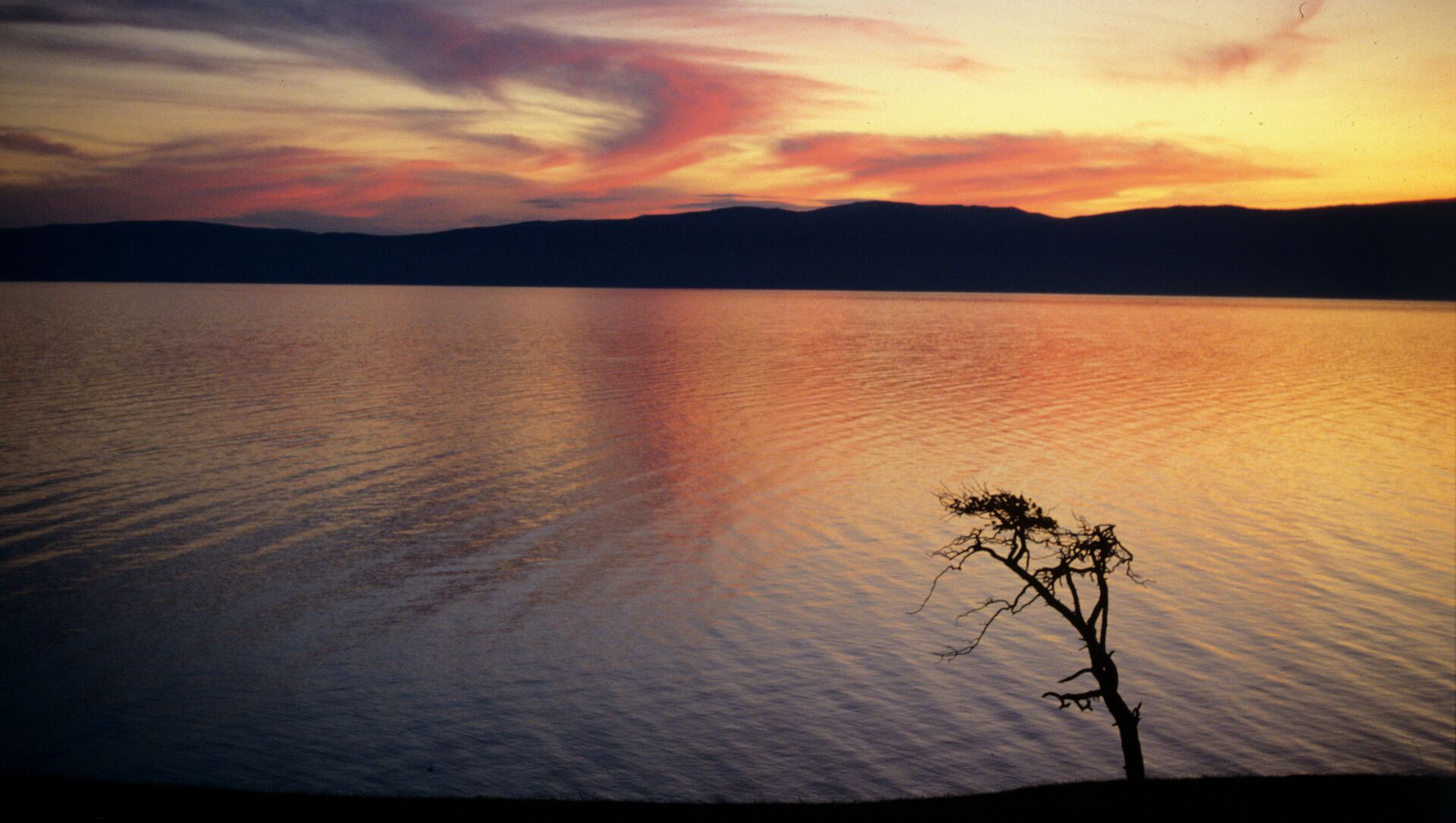
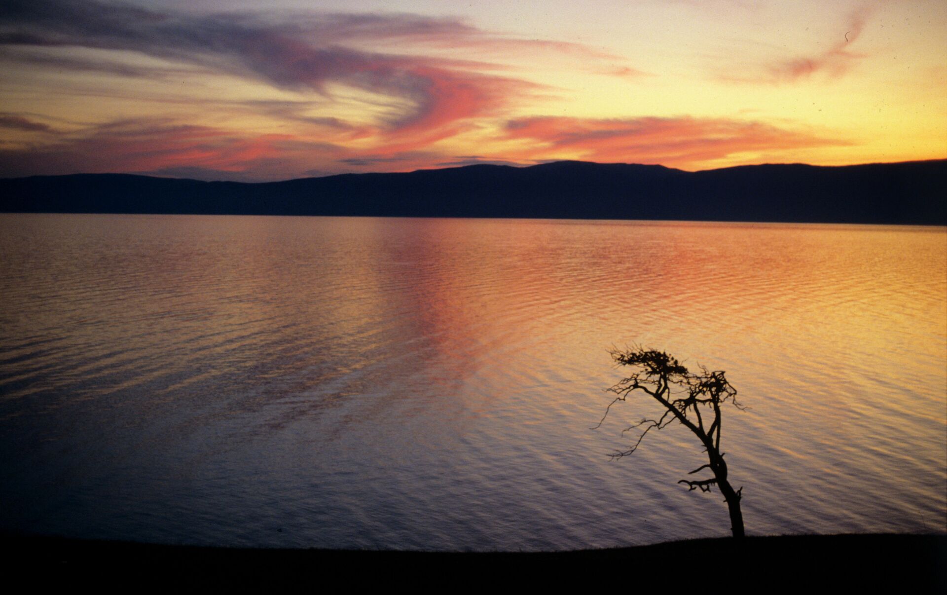
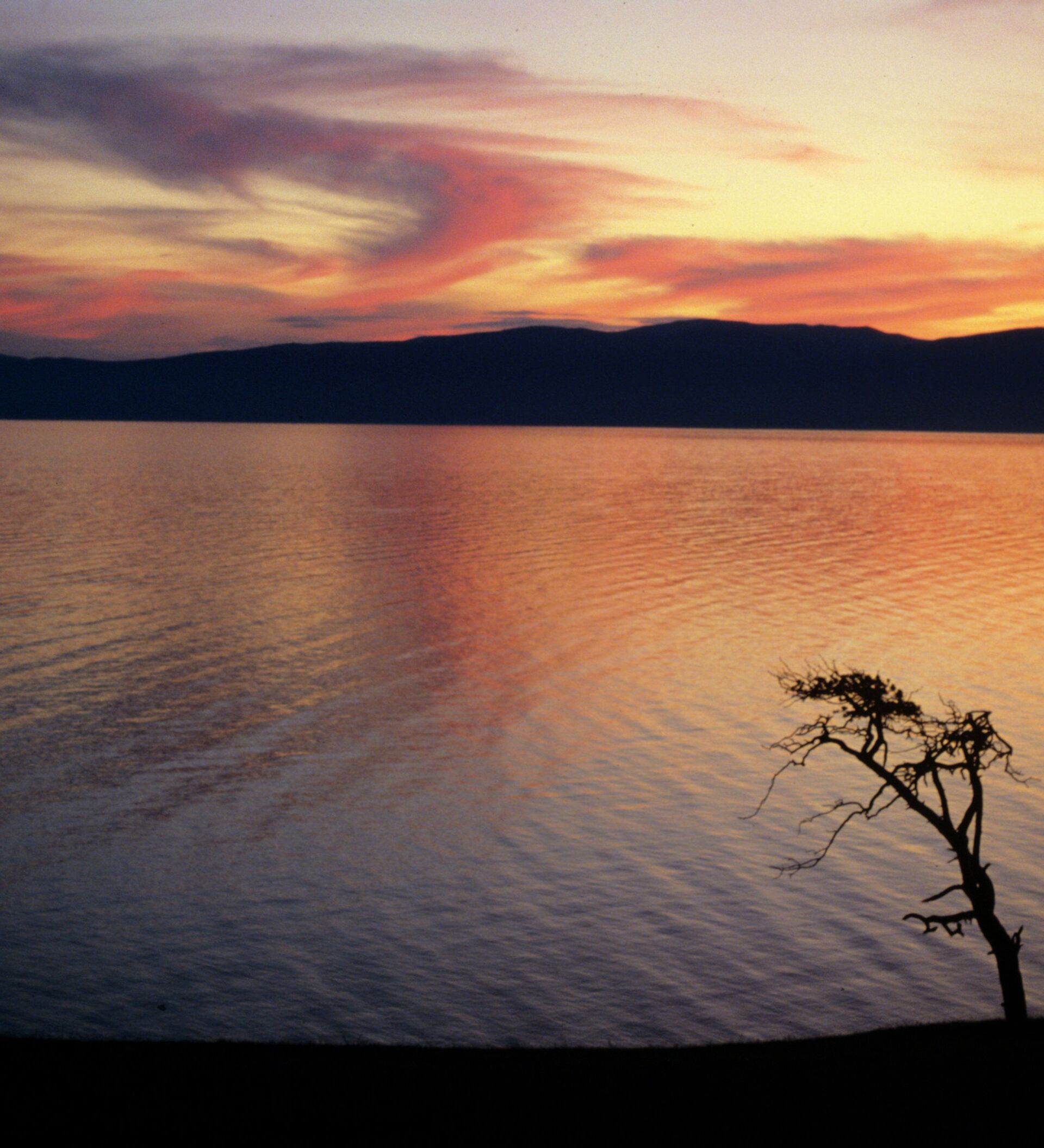
Lake Baikal, the deepest and cleanest lake in the world, forms part of the border between the Irkutsk Region and Buryatia in Southeastern Siberia.

Klyuchevskaya Sopka, the tallest active volcano in Eurasia, is located in the eastern section of the Kamchatka Territory. The volcano spews huge soot, smoke and gas plumes two or three times a year. The plumes rise 10 to 20 km into the atmosphere. As they subside, they travel halfway round the world.


